Syria
Physical Geography
Total Area: 71,479 square miles
Land Area: 70,692.7
Water Area: 786.3 square miles
Size in comparison to the United States: 1:137.5
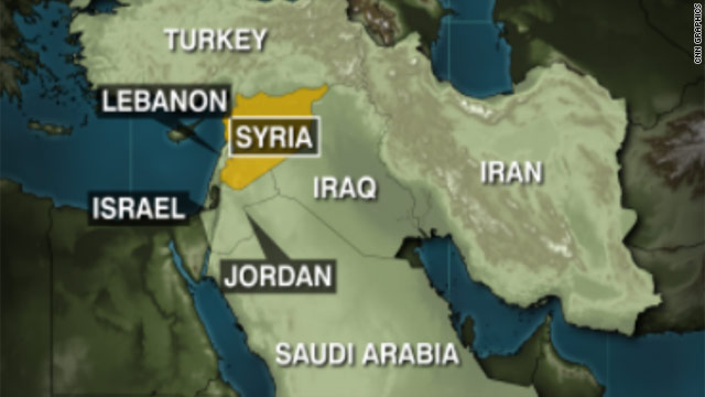
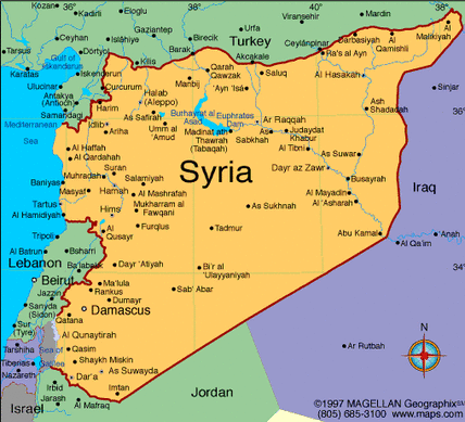
Bordering Countries: Israel, Lebanon, Jordan, Turkey, and Iraq
Distance of all land borders: 2,253 km
Total distance of coastline: 193 km (120 mi)
Description of climate: Hot, dry, desert summers; mild rainy winters along with occasional snow
Description of terrain: Mostly rock desert plateau, includes a narrow coastal plain along with some mountains in the western side of the country
Point of lowest elevation: Area near the sea of Galilee, -200 meters
Point of highest elevation: Mount Hermon, 2,814 meters
Land Area: 70,692.7
Water Area: 786.3 square miles
Size in comparison to the United States: 1:137.5
Bordering Countries: Israel, Lebanon, Jordan, Turkey, and Iraq
Distance of all land borders: 2,253 km
Total distance of coastline: 193 km (120 mi)
Description of climate: Hot, dry, desert summers; mild rainy winters along with occasional snow
Description of terrain: Mostly rock desert plateau, includes a narrow coastal plain along with some mountains in the western side of the country
Point of lowest elevation: Area near the sea of Galilee, -200 meters
Point of highest elevation: Mount Hermon, 2,814 meters